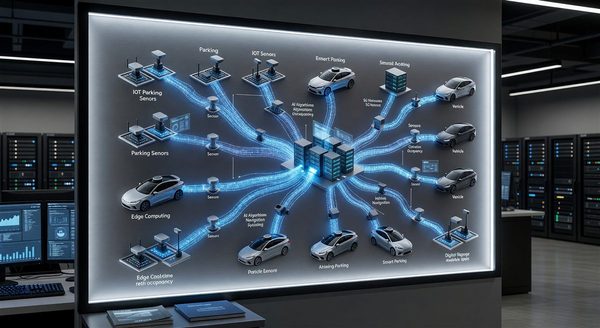
Curbside Management Technology: Tools for Dynamic Curb Allocation
The curb — that strip of pavement between the street and the sidewalk — has become one of the most contested pieces of urban real estate. On a single urban block, the curb may need to accommodate transit stop operations, TNC (ride-hail) pickup and dropoff, commercial delivery, personal vehicle parking, bike share docking, and scooter operations — simultaneously, and with activity that varies by time of day and day of week.
Traditional static signage (red zones, no-parking hours, loading zones) cannot accommodate the dynamic nature of modern curb demand. Technology — sensors, enforcement cameras, data platforms, and digital signage — enables dynamic curb allocation that adjusts in real time to actual demand.
Why Curb Management Has Become a Priority
Several converging trends have elevated curbside management from a minor operational concern to a strategic priority:
E-commerce delivery growth: Package delivery volume has increased dramatically, with delivery vehicles competing for limited curb space. Double-parking by delivery vehicles — a consequence of inadequate loading zone supply — contributes significantly to urban congestion. NACTO estimates that in dense urban cores, delivery vehicles may occupy curb space for a substantial fraction of the day.
TNC proliferation: Uber, Lyft, and similar services have added a new high-turnover curb user that existing curb designs did not anticipate. TNC vehicles stopping in travel lanes (because curb space is unavailable) create safety and traffic flow problems.
Micromobility: E-scooters and bike share docking require dedicated curb zones that didn’t exist in most cities before 2015.
Transit priority: Transit agencies seeking to improve bus speed and reliability require bus stop zones free of encroachment.
Technology Components
Sensor-Based Occupancy Detection
Curb management technology starts with detecting what is actually at the curb:
Ultrasonic sensors: Ground-mounted ultrasonic sensors detect vehicle presence in parking and loading zones, providing real-time occupancy data. Limitations: ground-mounted installation in roadway conditions is expensive and subject to damage.
Computer vision / overhead cameras: Cameras positioned to view the curb provide flexible detection — identifying vehicle type (car, truck, TNC, transit), occupancy duration, and double-parking in adjacent travel lanes. Computer vision can classify vehicle types in ways that simple presence sensors cannot.
Lidar: Lidar sensors mounted at fixed points (poles, overhead structures) provide precise vehicle dimension data that enables vehicle classification (passenger vehicle vs. commercial vehicle) beyond what cameras can reliably provide in adverse lighting.
In-roadway sensors: Some jurisdictions have deployed roadway embedded sensors similar to parking lot in-ground sensors for curb monitoring, though installation and maintenance costs are high in active roadway environments.
Dynamic Signage
Digital curb signs that can be remotely updated allow operators to change curb allocations without installing new physical signs. Configurations that would require expensive sign replacement in a traditional model (changing a parking zone to a loading zone during delivery peak hours) become a software operation with digital signs.
E-paper curb signs: Low-power, high-visibility electronic paper displays that show current curb rules. Remote update capability allows policy changes without field operations.
LED matrix signs: Higher-brightness LED signs that are more readable in direct sunlight and support more complex messages, at higher power cost.
Integration requirements: dynamic signs must integrate with curb management software to reflect the current curb policy accurately. A sign that shows an outdated policy due to communication failure creates enforcement and user experience problems.
Enforcement Technology
Curb rule enforcement is the mechanism that makes curb policy effective. Technology tools for curb enforcement include:
Mobile LPR enforcement: Enforcement vehicles equipped with LPR cameras can record curb violations at scale, enabling citation issuance for overtime parking and zone violations.
Fixed camera enforcement: Fixed cameras at high-priority curb locations (bus stops, loading zones, TNC zones) can enforce no-stopping rules automatically. Several cities have deployed fixed-camera bus-only lane enforcement using this technology.
LIDAR-based enforcement: Some enforcement systems use LIDAR to measure vehicle stopping duration precisely, enabling enforcement of loading zone time limits.
Data Standards for Curb Management
MDS Curb
The Mobility Data Specification (MDS) Curb API, developed through the Open Mobility Foundation, provides:
CurbPlace: A standard for defining physical curb locations with unique identifiers, geometry, and attributes.
CurbPolicy: A machine-readable format for expressing curb rules — what activities are allowed or prohibited, for which vehicle types, during what time windows, and with what dwell time limits.
CurbEvent: A standard event format for curb occupancy changes — vehicle arrivals and departures, with timestamps and optional vehicle type classification.
MDS Curb enables interoperability between city curb management platforms and the operators (TNC companies, delivery fleets, transit agencies) that need machine-readable curb policy data to optimize their own operations.
CurbIQ and Commercial Platforms
Several commercial curb management platforms (CurbIQ, Coord, Accenture Curb Management, and others) provide SaaS platforms for city curb management. These platforms typically provide:
- GIS-based curb inventory mapping
- Policy management with digital sign integration
- Occupancy monitoring dashboard
- Enforcement workflow support
- Analytics and reporting
Platform selection for city programs typically involves evaluation against the specific use case mix (delivery, transit, TNC, general parking) and integration requirements with existing city systems.
TNC and Delivery Zone Management
TNC Drop-Off/Pick-Up Zones
Designating specific curb space for TNC activity concentrates the curb demand from TNC operations into managed zones, reducing double-parking and improving predictability for both drivers and pedestrians.
TNC zone management technology:
- Geofencing: TNC platforms can geofence designated pickup/dropoff zones, guiding drivers to correct locations through the app
- Occupancy sensing: Monitoring TNC zone utilization to right-size zone capacity
- Digital enforcement: LPR or camera enforcement of TNC-only zone restrictions
Commercial Vehicle Loading Zones
Commercial vehicle loading zone management is among the highest-value curbside management applications given the congestion impact of delivery double-parking.
Digital permitting: Online permitting systems that allow delivery companies to request temporary loading zone access, enabling better planning of curb use by known commercial operators.
Dynamic loading windows: Adjusting loading zone hours based on observed delivery demand — extending loading zone hours in commercial areas during peak delivery windows, converting zones to passenger parking during off-peak periods.
FAQ
Which cities are leading in curb management technology deployment? Seattle, Los Angeles, New York City, Washington DC, and San Francisco have deployed curbside management technology programs at meaningful scale. Columbus, Ohio deployed sophisticated curb management technology as part of its USDOT Smart City Challenge program. Internationally, Amsterdam and Singapore have advanced curb management technology deployments integrated with broader smart mobility programs.
How do delivery companies access machine-readable curb policy data? Companies like Amazon, FedEx, and UPS are active participants in MDS Curb development precisely because machine-readable curb data enables their route planning tools to identify legal delivery locations rather than defaulting to double-parking. Cities publishing MDS CurbPolicy data enable delivery companies to route drivers to legal stops — a mutual benefit for city traffic management and delivery operations.
What is the return on investment for curbside management technology? ROI for curb management technology includes reduced congestion (with economic productivity value), reduced citations and associated friction, improved transit reliability (where bus stop enforcement is a component), and in some programs, increased curb-based revenue from permit programs. Quantifying these benefits requires careful before-and-after measurement. NACTO’s Urban Street Design Guide and ITE publications include case study data from early curb management technology deployments.
Can curb management technology help with emergency vehicle access? Some advanced curb management programs include emergency vehicle clearance protocols — real-time notification to fleet management platforms that routes vehicles away from specific curb zones during incidents or emergency operations. This is an emerging application rather than a widespread deployment, but the technical infrastructure (connected curb signs, real-time data platforms) supports it.